Background
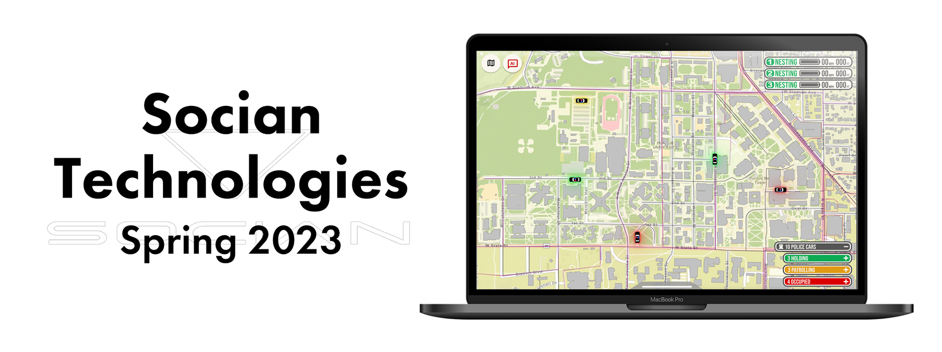
As a team, we are working on a map interface for future integration with Socian Technologies. Our project will primarily be based on the exploration of drone mapping with a focus on first responder communication, general map and data visualization, vision sensor integration, rival drone research, artificial intelligence assimilation, and analysis of stakeholders.
Project Sponsor
Socian Technologies
Socian Technologies
Project Timeline
Spring 2023
Spring 2023
Team
Myself
Garrett Fitzgerald
Faye Ochi
Rohan Pant
Aashika Parekh
Kelley McTyer
Logan Carter
Myself
Garrett Fitzgerald
Faye Ochi
Rohan Pant
Aashika Parekh
Kelley McTyer
Logan Carter
Personal Contributions
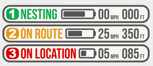
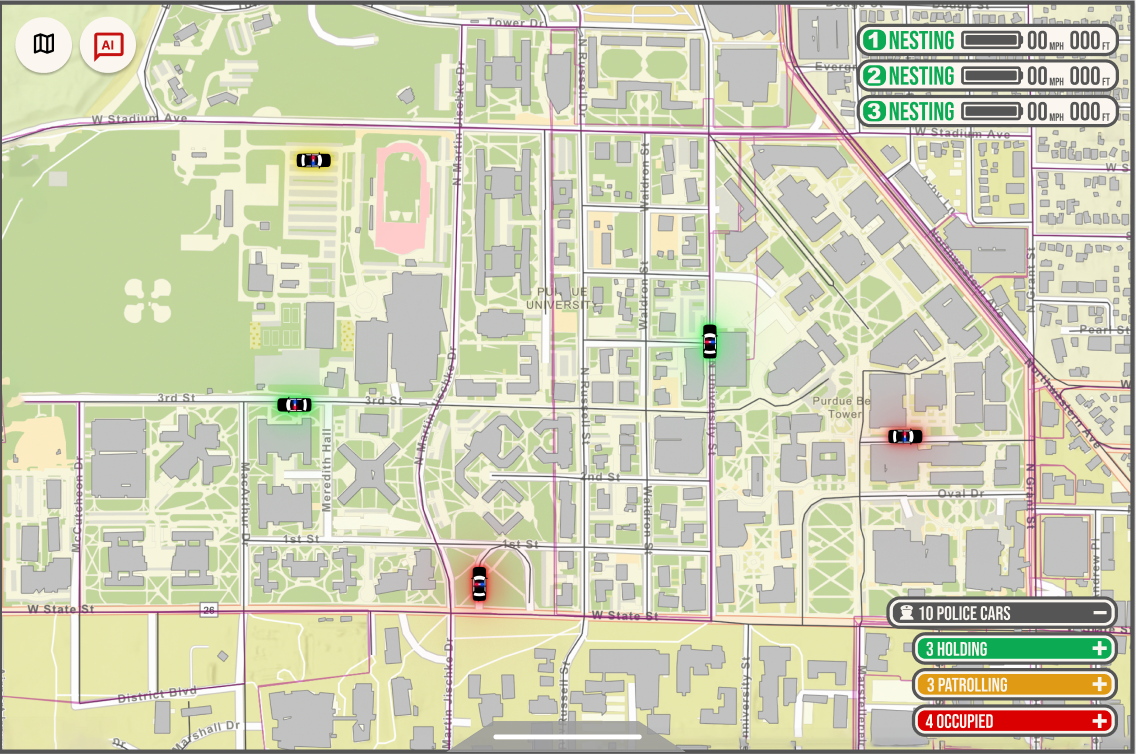
•Drone Status Widgets
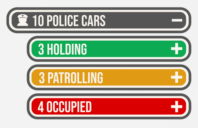
•Police Status Widgets
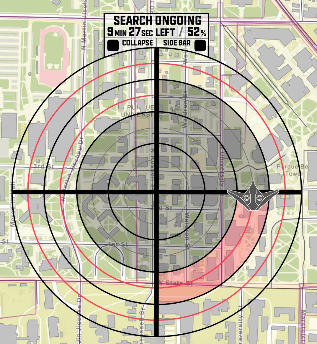
•Searching Interface
•Design System
•Police Status Widgets
•Searching Interface
•Design System
Tools Used
•Miro
•Figma
•Adobe Illustrator
•Adobe Photoshop
•Figma
•Adobe Illustrator
•Adobe Photoshop
Skills
•Competitive Analysis
•User Interviews
•Hi-Fideltiy Mockups
•User Interviews
•Hi-Fideltiy Mockups
_____________________________________________________________________
Problem Space
How can we design an interface for 911 dispatchers who will be controlling and monitoring drones.
How can we design an interface for 911 dispatchers who will be controlling and monitoring drones.
Goals
•Understand the needs of our target audience through user interviews and testing.
•Utilize our research to design a cohesive interface that is easy to use
•Utilize our research to design a cohesive interface that is easy to use
_____________________________________________________________________
Our Research
Dispatcher Tour
In order to gain a better understanding and background of our user group, 911 dispatchers, we went to West Lafayette Police Department’s dispatcher center on Purdue’s campus.
Takeaways
•Drone are mainly used for missing persons and for surveying large areas of terrain
•Drones and surveillance cameras have the ability to read license plates, but do not have facial recognition
•The live feed from the drones will be helpful in many cases as they can lock the movement of the suspect
•Drone are mainly used for missing persons and for surveying large areas of terrain
•Drones and surveillance cameras have the ability to read license plates, but do not have facial recognition
•The live feed from the drones will be helpful in many cases as they can lock the movement of the suspect
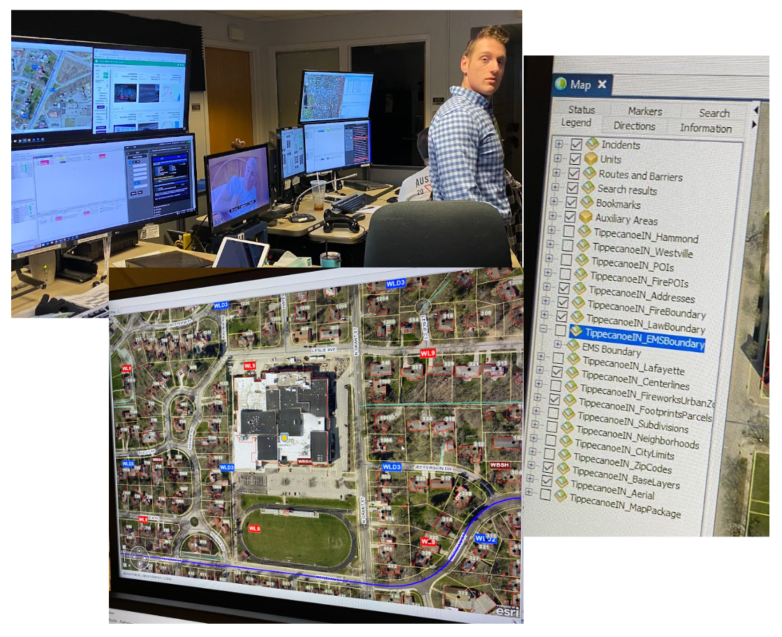
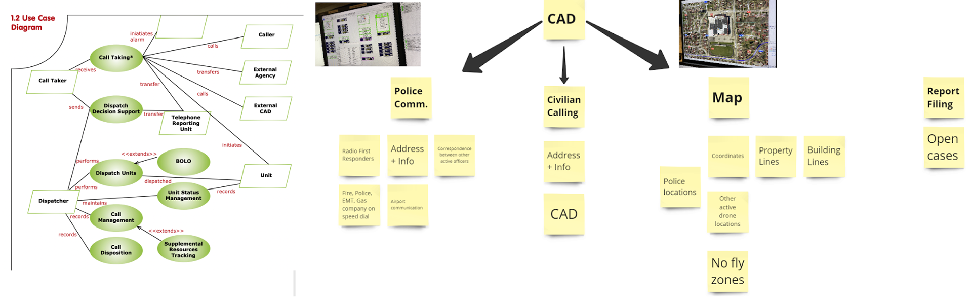
Background Research
Here we have combined everything from the interviews and the things that we found in our secondary research so that we can finalize on the basic structure for the map. We also tried to incorporate our ideas so that we can better address this problem space and make drone maps similar to the current CAD system that they use so there is no new learning curve for the dispatcher who is using our map for
Here we have combined everything from the interviews and the things that we found in our secondary research so that we can finalize on the basic structure for the map. We also tried to incorporate our ideas so that we can better address this problem space and make drone maps similar to the current CAD system that they use so there is no new learning curve for the dispatcher who is using our map for
Interview Insights Sorted
User Testing
Our goal was to test out our designs with a dispatcher, to see how effective they were. We also wanted to test how easily understandable the designs would be for a 911 dispatcher.
Approach
To do this, we talked to a 911 dispatcher over Zoom about our designs. We showed them to him and asked for any feedback on the things he appreciated and things that could be changed about the designs.
Insights
•Their setup is already complicated and they do not want to feel overloaded
•Police codes are important to add, but not the full address
•Wanted to be able to add nuance to the drone’s knowledge
•Likes being able to change the visibility of the drone to help with not escalating the issue
•Enjoy features like color coded units to know what police on duty are doing
•Wants layers to be less visible because they are not used often
_____________________________________________________________________
Hi-Fidelity Mockups